GrVis
Communicating and deliberating services of riverine zones effectively – Prototype of a visualization platform
Riverine zones serve as habitat for plants and animals, as space for recreation and identification for the people, they provide fresh water, and protect against floodwater or are economic production areas. These services of the riverine zones contribute to our human wellbeing. In Switzerland, a lot of rivers are shored. About 42 % of the river courses do not provide the services sufficiently. The revision of the river protection (GSchG, 1st of January 2011) obligates the Cantons to define new riverine zones. Thereby an informed trade-off decision-making of the economic, ecological and social services of the riverine zones should take place. For communicating and deliberating the services in practice effectively, indicators of the services should be prepared in form of a visualization platform.
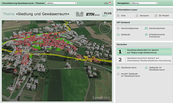
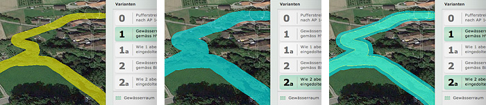
Goal of the project is to develop a platform with 3D visualizations of concrete areas and link them with indicators of relevant services of the riverine zones (as the value of buildings, costs for revitalization, recreational function). Result is a prototype for testing and further specification of the functionality.
Website
Project data
Duration
Oktober 2012 bis September 2013
Funding
AWEL Amt für Abfall, Wasser, Energie und Luft, Kanton Zürich
Project team
Prof. Dr. Adrienne Grêt-Regamey
Ulrike Wyssen Hayek
Michaela Teich
Thomas M. Klein
external page Ralph Sonderegger
Contact
Prof. Dr. Adrienne Grêt-Regamey
www.plus.ethz.ch